Hydroinformatics ▪ Climate Change ▪ Remote sensing ▪ GIS ▪ Modelling.
sara4r - An R-GUI for Spatial Analysis of surface Runoff using the NRCS-CN method
Software availability
Developer: Rafael Hernández-Guzmán
Contact address: INIRENA-UMSNH. Av. San Juanito Itzícuaro s/n. Col. Nueva Esperanza. CP 58330. Morelia, Michoacán, México
Email: rhernandez.g@gmail.com
First year available: 2020
Software requirements: Tested in R version 4.1
Hardware requirements: General purpose computer
Programming language: tcltk
Availability and cost: sara4r is available at the Comprehensive R Archive Network.
Description file
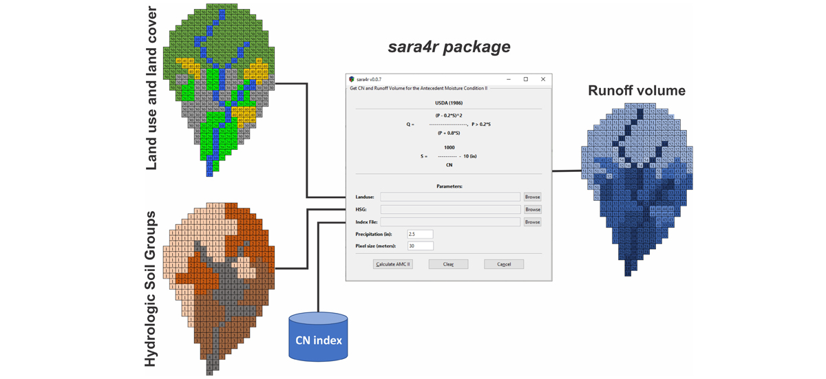
A Graphical user interface (GUI) to calculate the rainfall-runoff relation using the Natural Resources Conservation Service - Curve Number method (NRCS-CN method) but include modifications by Hawkins et al., (2002) about the Initial Abstraction. This GUI follows the programming logic of a previously published software (CN-Idris, Hernández-Guzmán et al., 2011 - CN-Idris: An Idrisi tool for generating curve number maps and estimating direct runoff. Environmental Modelling & Software, 26(12), 1764-1766). It is a raster-based GIS tool that outputs runoff estimates from Land use/land cover and hydrologic soil group maps.
This package is under development at the Institute about Natural Resources Research (INIRENA) from the Universidad Michoacana de San Nicolás de Hidalgo and represents a collaborative effort between the Hydro-Geomatic Lab (INIRENA) with the Environmental Management Lab (CIAD, A.C.).
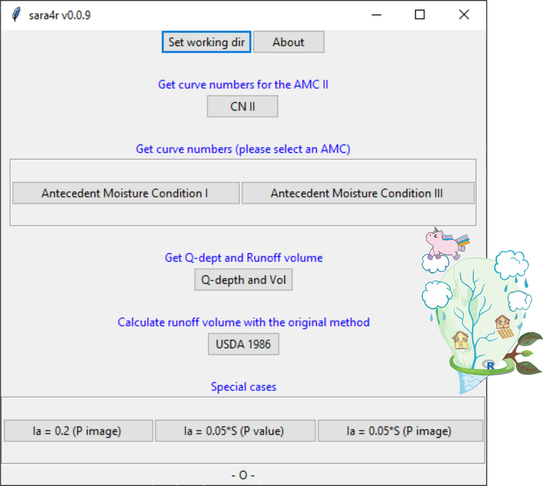
sara4r interface
sara4r Logic

How to install
sara4r package is a Graphical User Interface developed in tcltk and depends on other libraries to run (tcltk2, raster, sp, rgdal). Thus, to make available sara4r in the R environment you must install tcltk2 first, then the raster, sp and rgdal packages
How to run
To run sara4r just type library(sara4r) to activate de library. Then type the function sara4r( ) and you will see the main interface.
How to cite
Hernández-Guzmán R., Ruiz-Luna A., Mendoza E. (2021). Sara4r: an R graphical user interface (GUI) to estimate watershed surface runoff applying the NRCS – curve number method. Journal of Hydroinformatics, 23(1), 76-87. https://doi.org/10.2166/hydro.2020.087